
Map of the Upper Sound Country comprising parts of the counties of Pierce, Thurston, Kitsap, Mason and King, Washington
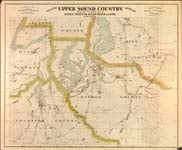
| Origin/Agency/Author: | Plummer, Henry G |
|---|---|
| Publisher: | Tacoma, Wash. : Mason Mortgage Loan Co., [between |
| Date: | [between 1889 and 1900?] |
| Size: | 68 x 83 cm |
| Condition: | Fragile |
| Note: | Map has been reduced in size for online presentation. |
| Location: |
State Library For complete citation |
| View Map: | JPEG |